When I saw that the Bibliothèque nationale de France had an exhibition on imaginary maps (Cartes Imaginaires: Inventer des mondes) right at the time we were visiting Paris, I knew we had to go. BnF exhibitions have never disappoint. They have a particular quality I’ve come to rely on, a kind of curatorial confidence that makes even unfamiliar subjects feel worth your time. I felt this at the Tolkien exhibition in 2019, standing in front of his handwritten manuscripts and hand-drawn maps of Middle-earth, moved by something I couldn’t entirely explain. I expected Cartes Imaginaires to do something similar: to delight me with imaginary maps and geographies, and send me back into Paris feeling pleasantly expanded.
The impact, when it came, turned out to be something quite different.
The exhibition opened, logically enough, with the oldest maps – cartography from an era before the world had been fully walked, before accounts existed of what lay beyond the horizon. What these mapmakers knew of distant lands came largely from travellers’ reports, from scripture, from classical texts, from the accumulated imagination of people who had never been there. So they filled the gaps the only way they could: with chimeras, with sea monsters, with dog-headed men at the edges of continents.
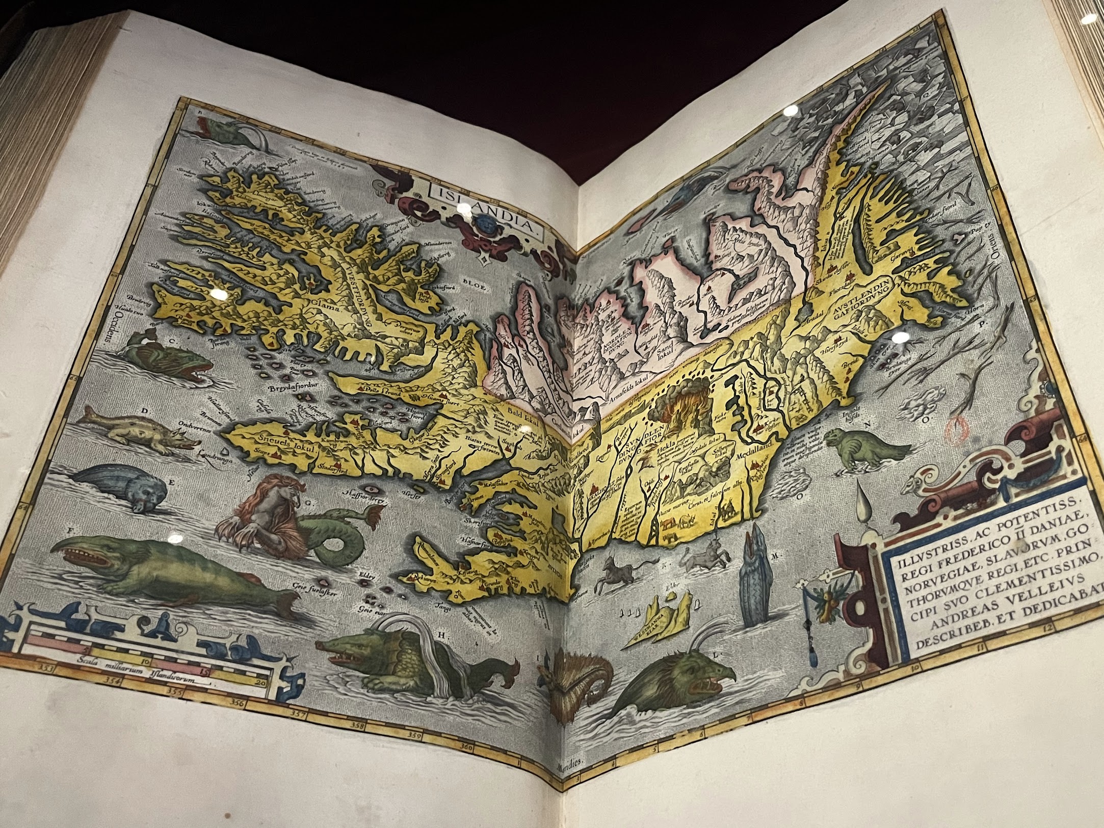
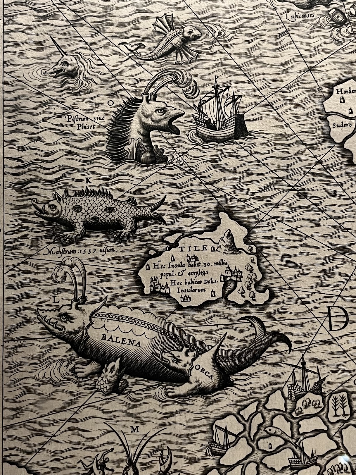
I found myself initially amused by this, by the confident specificity of the creatures inhabiting the margins – this is where the blemmyae live, over here there be dragons – the way anxiety about the unknown gets transmuted, through drawing, into something almost decorative.
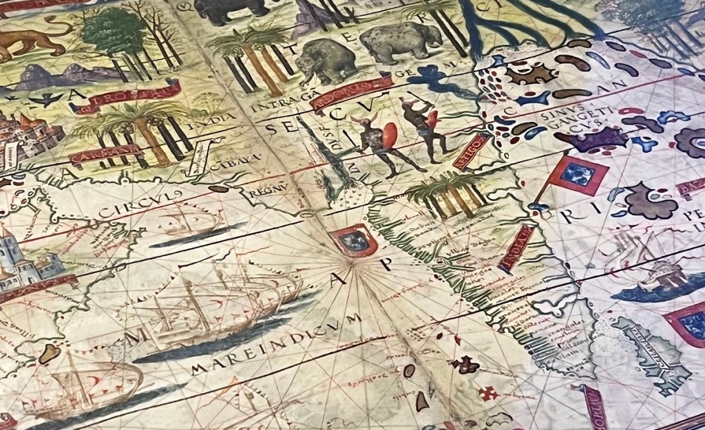
And then, gradually, I found myself unsettled. Because as the maps became more recent and more detailed, something stranger started to happen, not in the explicitly fantastical maps, but in the ones claiming to be accurate. Abraham Ortelius’s 1579 Theatrum Orbis Terrarum shows Indostan dense with named cities, river systems, trade routes – because by the 16th century, India was already a sophisticated network of city-states and trade hubs, Calicut and Cambay and the legendary wealth of the Mughal Empire threading through global commerce. It wasn’t nature. It was a peak of human engineering and organisation.
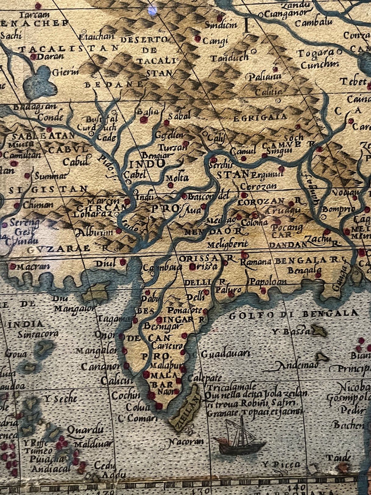
The same map shows the Americas as coastline trailing into blankness – frontier land, vast and rugged, still waiting, apparently, to be discovered by the very people who would later claim they brought civilisation to the East.
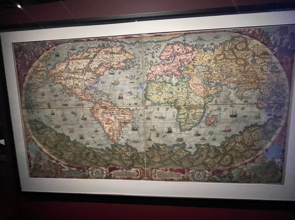
What is this if not a form of Evolution Paradox with these maps as its most honest record? History written by the victors tells us a clean story: a linear path of progress from West to East, civilisation radiating outward from Europe. But maps drawn before the rewriting show something else entirely. They show a world in which the East was already connected, abundant and complex, and the West was still finding its edges. The “development” that followed wasn’t built in a vacuum. It was built atop the systematic dismantling of systems that had already evolved, over centuries, into something remarkable.
When you look at these maps slowly, you aren’t just looking at geography. You are looking at a blueprint of the world before it was rewritten. And you can’t help but ask: where would we be today if that evolution hadn’t been interrupted by the ego of empires?
I came back to India carrying that question. Watching Olusoga’s series on the British Empire around the same time didn’t help; if anything, it made the question louder.
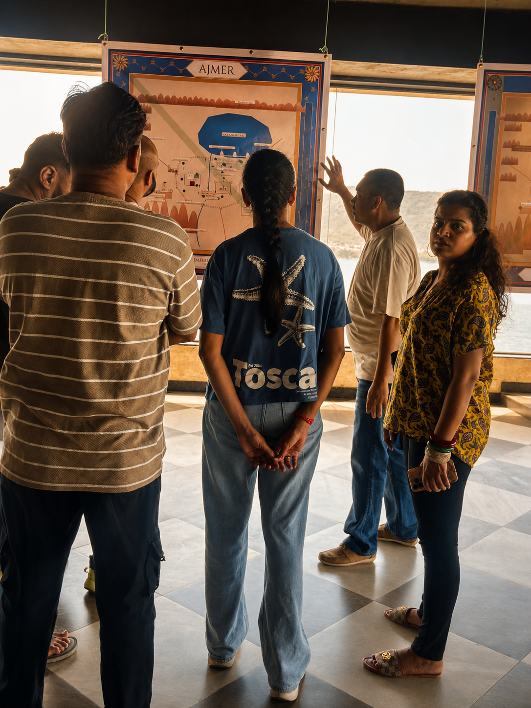
At Project Bhaskar, we had just opened 1000 Years of the Valley, a scenographic exhibition on the history of Ajmer. When we started designing it, we had been clear from the beginning about what it shouldn’t be: information on walls, dates in sequence, history as something you read and move past. The vision was for visitors to move through a landscape of maps, timelines, archival material and visual storytelling – to experience the city spatially rather than sequentially, the way you might actually come to know a place. Cartography, historical research, and scenography collapsed into a single immersive room. Because sometimes the best way to understand a city is not to read its history, but to walk through it.

The question underneath it is the same one the Ortelius map had sharpened for me: how does a city that was once ajayameru – unconquerable, strategically indispensable, the city from which the Mughals negotiated with the British, whose dargah drew emperors as pilgrims – how does such a city end up classified Tier 3? The answer, I think, is that unmapping is not accidental. It is what happens when one civilisation’s story gets told loudly and long enough that the complexity underneath it stops being legible. Ajmer is one example. There are hundreds of others.
Which is why I think these old maps deserve more of our attention than we give them. We live now with Google Maps and satellite imagery and AI tools that can describe almost any place on earth in seconds, and I think this has made us careless. We use maps to navigate and then close them. We trust their confidence without asking what’s outside their frame. But the question of whose complexity gets rendered in detail, whose streets get named, whose history gets indexed, whose city gets written about in enough languages to surface when the algorithm goes looking has not gone away. The distribution of detail on a digital map still follows, not so differently from 1579, the distribution of economic activity and political attention and who has been considered worth documenting.
Maps have always been arguments about what matters. The Ortelius atlas argued, without meaning to, that a civilisation’s worth was proportional to a European cartographer’s knowledge of it. Our current maps make subtler versions of the same argument every day.
Which is why these old maps are still worth looking at. Not as antiques, or curiosities, but as evidence of what the world looked like before one particular story about it became the only story. A reminder that the rewriting happened, that it was not inevitable, and that what it buried was not less real for having been buried. Where would we be today if that evolution hadn’t been interrupted? I don’t know. But I think revisiting old maps can at least show us what was interrupted.

Leave a comment